Category Archives: Post-Industrial Landscape

The imagined lake: Storsjön, Sweden

To the south of the city of Borås in Sweden, there is a lake. It used to be three lakes, back before the 20th century brought with it the ever-increasing demands of a thirsty textile industry. The lake was imagined into existence. Someone stood and looked and saw and the possibility. They looked over a landscape of woodland and fields, three lakes surrounded by farms and crofts, and they imagined the tunnels and the dam, the water rising by ten metres. Imagination became reality. The three lakes slowly but surely met each other in the middle. Lake Storsjön was born.

Not that it is easy to tell this is an artificial lake, 107 year’s old, when you stand at the sandy beach close to the parking places and the clubhouse of the local cross-country skiing and running club that has trails leading out from here through the forests and around the lakeshore. At first you think you have found what it is you were looking for. A place hidden away from the modern world. Still wild. Forgotten. Timeless.

Continue reading

Trans-Pennine Express

At Manchester Airport we climb aboard. Tired travellers struggle down the narrow aisle in search of empty seats, lifting wheeled cases and plastic bags of fags onto the overhead shelves before sitting down heavily with hungover smiles. An announcement warns of travelling on the wrong ticket, inducing slight beats of panic in even those passengers whose paperwork is in order. And then, with a jolt and a lurch, we are off.

Northern England passes by outside the window. We are travelling across the Pennines from Manchester to Leeds, a journey I used to take from home in Lancashire to university in Yorkshire. Crossing the great divide. Lotte asks me what has changed. Not much, I say, as we look down on suburban back gardens and their trampolines, the overgrown edgelands between the tracks and the back fence a tangle of bushes, brambles and fly-tipped waste. Across the rooftops we spy a cricket pitch and a primary school. 20th century blocks of flats and more modern, sandstone-coloured new-build estates. Shipping containers and a mechanic’s yard. An ice cream van under an overcast sky. Pink and white blossom adding colour to the scene. Continue reading

Postcards from the Edge, Part Ten: The Long Silence of the Factory Bell

For the past few months I have been walking the outskirts of Berlin for a new book project. Along the way I published a series of postcards from the edge here on Under a Grey Sky. The walks are now completed, and you can find the postcard archive here. Now I just need to write the book…

Outside the old brewery friends gather in the spring sunshine, taking a seat on one of the benches that line the waterfront north of Spandau’s old town. There has not been beer produced here for a long time. Instead, the old brewery has been transformed, with a mix of re-purposed old red-brick buildings and architecturally complementary new-builds to create a harbourside complex of apartments and a ‘premium residence’ old people’s home, with restaurants and cafes on the ground floor. The view from the upper floors includes both the citadel and the power stations beyond.

An iron bridge takes me across the river to an island. The remnants of an armaments factory still stand, re-purposed during the Cold War to store the reserves of the West Berlin government should the USSR attempt another blockade of the island city. Now the warehouses and factory spaces are used for events, part of a multi-million euro plan to re-invent this island on the Havel as a residential and commercial zone. The landscaped paths and gardens are ready and waiting. As are the jetties and landing stages. Only the apartments remain imaginary; depicted on a billboard that stands on the edge of a muddy expanse of wasteland.

The re-imagining and re-purposing of places and spaces built for very different uses can take time. Off the island once more, the old industrial complexes that fuelled the rapid rise of Berlin in the second half of the 19th century are now less about making things and more about providing space for those 21st century activities that have square metres as the highest priority when it comes to real estate. Film studios and storage halls (private and commercial). Indoor football pitches and paintball. Logistics companies and winter parking for campervans. Infrastructure is still important, but whereas once it was the canal, the river and the railway, it is now access to the autobahn and a pledge of high speed internet access that is offered up outside properties with square metres to spare.

Lots of space, but little passing traffic. A red kite hovers above a fenced-off strip of marshy land, that somehow escaped the city’s relentless advance. Apart from the odd car on the main road, there is little other movement to catch the eye. No one waits at the bus stop. No one is following me along the pavement. And across the street the billboards stand empty. In this corner of the outskirts, on a weekday morning, there is no one to advertise to.

Postcards from the Edge, Part Nine: Karolinenhöhe

Over the next few months I will be walking around the outskirts of Berlin, starting each walk where I finished the last, until I complete a loop of the edge of the city. These walks will be written up for a new book project, and here on Under a Grey Sky I will publish some postcards from along the way…

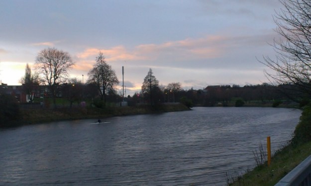
I walk away from the lake, up a narrow path that cuts along the bottom of a gorge formed by two steep wooded hills, the floor covered in soggy leaves. This sense of enclosure evaporates as I cross the street, following a path into an open expanse of fields separated by high pathway avenues. These are the Karolinenhöhe Rieselfelder, part of a series of sewage irrigation fields built in the second half of the 19th century to process the waste of the rapidly growing, industrialising city. These fields were set up outside Berlin’s limits back then, although by now the shifting boundaries outwards mean that most are contained within the outskirts. Some were in operation up until the 1980s, and are now either farmed or have been turned into nature reserves.

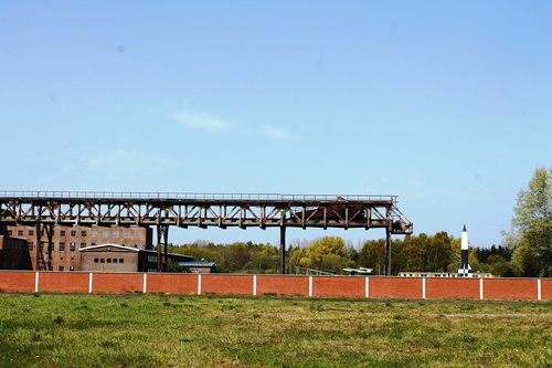
Here, just south of Spandau, the traces are more visible the other former sewage irrigation fields I have crossed during my walk. Mostly grassed over, there are tell-tale fixtures and fittings that speak to its previous function. Concrete canals and drainage ditches. Steep-sided basins. Cobbled service roads, lined with trees. I have been here before and yet it is just as strange as on the first visit. In a way it is emblematic of the outskirts as a whole. Neither city nor country. Aspects of both. An in-between place. An edgeland place.

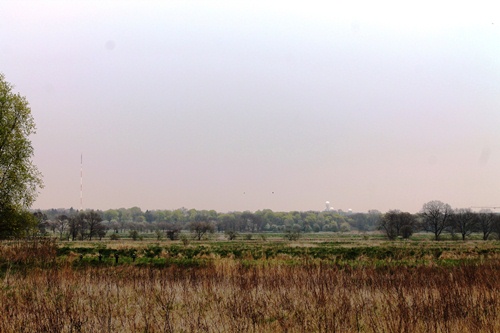
Most of all it reminds me of the polders on the banks of the River Oder, right where Germany meets Poland. To get to the river and the coloured boundary posts the path drops down from one dyke, crosses the dry polder, and then rises up to a dyke on the other side. All the way across you are aware that you are walking in a place that perhaps you shouldn’t. A place created by humans where, at any moment, the water’s could rise and you would be literally up to your neck in it. At Karolinenhöhe I have a similar, uneasy-yet-illogical feeling, and I find my pace quickens as I follow the raised service road in a diagonal line towards the very edge of Berlin, on the other side.

Caught by the Lagan, Belfast

Lagan3

Upstream

On a Sunday morning I meet the river by the entrance to Ormeau Park and turn left along the embankment, heading upstream. On the bridge railings a ghost bike hangs, painted white in memory of a fallen cyclist. Below me, on the water, a solitary rower aims downstream, towards Belfast Lough and the sea, towards the waterfront developments of the city centre and the yellow cranes of the shipyard, stroke after powerful stroke.

My route takes me past the gable end of terraced houses and the entrance to Botanic Gardens. There is no life in the Lyric Theatre this early, and I share the pavement with a couple of cyclists and a young woman walking purposefully past me towards town. Across the street tattered flags stake territorial claim on an estate lining a ridge above the river, looking down on an open grassy space where the bonfire will be built. An underpass takes me beneath the road about to cross the river and I pause at a sign marking the riverside route. The inscription begins: Continue reading

Sunshine on Leith (and Newhaven)

Leith3

At the end of the Western Harbour breakwater we came to the abandoned lighthouse and climbed through a hole in the fence. The view back across the harbour was spectacular, to Leith and the Royal Yacht Britannia, and beyond the Arthur’s Seat, the castle, and the rest of the Edinburgh skyline. We picked our way cautiously through the broken stone and glass spreading out from the open doorways of the lighthouse. Graffiti and litter. Evidence of illicit parties. Few better places, on a clear day like this, looking across the Firth of Forth with a fly-by of eider ducks, exiting the harbour ahead of a Spanish warship.

Below us, on the slippery stones just above the waterline, a couple of fisherman discussed strategy. One was teaching the other, acting out the motions with empty hands as his friend gripped the rod intently. They both ignored the signs warning about eating shellfish from this particular shore.

Continue reading

The Wiesenbeker Teich and the underground history of the Harz Mountains

Wies1

We returned to Berlin a week or so ago from our summer travels through Germany and France, straight back into the hectic normality of everyday life, and with a notebook filled with scribbles and reflections on the places we have seen and experienced. So where to start? On page one of course, and a man-made lake at the southern edge of the Harz Mountains…

On our second morning at the Wiesenbeker Teich and we emerged from our tents to a view of the forested mountains above the lake shrouded in mist. There was some rain in air, and from our camping spot above the water, it looked as if the lake itself was smoking in the early morning gloom. Apart from the campsite, there is not much around the lake. A crumbling hotel stands at the end closest to the town of Bad Lauterberg, but otherwise it is steep-sided hills falling into the water, with trees growing all the way down to the water’s edge.

Continue reading

The ambivalence of technology at the mouth of the Peene River

Peene1

The first clues to the history of the village of Peenemünde, at the northern end of the island of Usedom, were the military signs amongst the trees on either side of the road that swept through the forest. Much of the countryside around the village remains restricted, as it has been since 1936 when the whole northern peninsula of the island was purchased by the Reich Air Ministry. Alongside the airfield, the German Army also established a research centre under the technical leadership of Wernher von Braun, whose mother had in fact recommended the site as “just the place for you and your friends”.

Von Braun was a rocket engineer, and the centre at Peenemünde was tasked with the development of the guided missiles and rockets that would, by the end of World War II, bring death and destruction to cities across Northern Europe. Altogether, the V1 rocket would be used some 22,000 times, and the later V2 on at least 3,000 occasions, including over a thousand aimed at London. An estimated 2,754 Londoners were killed in the rocket attacks, with a further 1,736 killed in Antwerp, Belgium, which had the dubious honour of being the Nazis most-targeted city with their new “miracle weapons” that were supposed to end the war in their favour. As it turned out, more people – mostly slave labourers – were killed in the production of these rockets than in their operation.

Continue reading

The Landscapes of Berlin

Cover

What do we think of when we hear the word “landscape”? The first thought might involve hills and mountains or endless prairie fields and wide, wide rivers. It might involve sea cliffs and beaches, bleak moors or a Postman-Pat patchwork of land divided into neat parcels by high hedges. Landscape feels like it should be somehow “natural”, and it is tempting to idealise it as such, even though there are very few places – especially in Europe – that can truly claim to have been untouched by the influence of humankind. After all, we introduced the sheep that tore away the natural vegetation of the Welsh hills and we planted the corn that waves back and forth across the Mid-West. But still, more often than not the word is used to describe something different to the built-environment of the city, which is why I remain amazed when I find those corners of Berlin where it feels as if no other word will do.

Continue reading

Vietnam in Berlin: The Dong Xuan Center

blog1

The district of Lichtenberg in the east of Berlin is certainly an interesting place. It has something of a troubled reputation, mainly due to the social and economic problems that the neighbourhood has had to deal with the in the two decades since the fall of the Berlin Wall. It is also home to a cemetery where the heroes of the socialist revolution, such as Karl Liebknecht and Rosa Luxemburg are honoured each January with the waving of red flags and a pile of red carnations. And it is home to, in an old industrial complex, to an ever growing corner of Vietnam in the German capital.

Continue reading